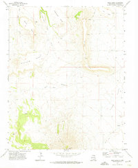
1971 Map of Mesa Larga
USGS Topo · Published 1974About this map
Laughlin Peak dominates the southern skyline of this high-altitude landscape in Colfax County, rising above a series of prominent tabletop formations. The intricate topography is defined by the expansive Mesa Larga and Blosser Mesa, which are separated by deep drainages like Blosser Arroyo and Cedar Canyon. These geological features tell a story of erosion and high-plains geography, where water sources like Little Water Cr and scattered springs provided essential resources for ranching and travel in this arid environment.
Find a feature on this map
19 named features on this map. Tap any name to fly to it.
Don’t see what you’re looking for? This feature index may not catch every label — zoom into the map to look around manually.
Map Details
Editions of this 1971 Mesa Larga Map
This is the sole edition of this map. No revisions or reprints were ever made.
Other maps of this area

1912 · Raton
USGS Topo · 1:62,500

1914 · Raton
USGS Topo · 1:62,500

1954 · Raton
USGS Topo · 1:250,000

1958 · Raton
USGS Topo · 1:250,000

1971 · Kiowa
USGS Topo · 1:24,000

1971 · Tres Hermanos Peak
USGS Topo · 1:24,000
1971 · Hunter Mesa
USGS Topo · 1:24,000

1971 · Robinson Peak
USGS Topo · 1:24,000

1971 · Johnson Park
USGS Topo · 1:24,000

1971 · Pine Buttes
USGS Topo · 1:24,000