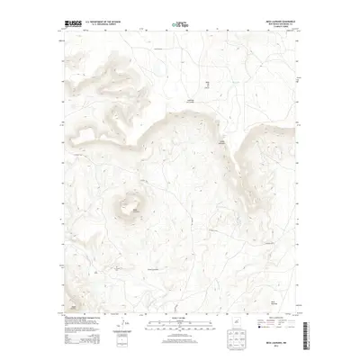
2013 Map of Mesa Lauriano
USGS Topo · Published 2013About this map
Mesa Lauriano dominates this high-elevation landscape in San Miguel County, where the high mesas and deep drainages of northeastern New Mexico are meticulously documented. The terrain is defined by dramatic escarpments like Mesa de los Carros and Mesa Montosa, cut by the winding course of the Gallinas River and the seasonal waters of the Indio Arroyo. Human presence is marked by a network of rural routes, including CO Road C48, which provides access to family landmarks and historical sites. For those researching local heritage, the Los Torres Cem stands as a significant point of interest near the southern canyons. Water management in this arid environment is evident through features like Hawk Windmill, Point Lake, and Big Tank, illustrating the ranching and agricultural requirements of the region at the start of the 21st century.
Find a feature on this map
15 named features on this map. Tap any name to fly to it.
Don’t see what you’re looking for? This feature index may not catch every label — zoom into the map to look around manually.
Map Details
Editions of this 2013 Mesa Lauriano Map
This is the sole edition of this map. No revisions or reprints were ever made.
Other maps of this area

1889 · Las Vegas
USGS Topo · 1:125,000

1890 · Bernal
USGS Topo · 1:125,000

1891 · Bernal
USGS Topo · 1:125,000

1891 · Las Vegas
USGS Topo · 1:125,000

1892 · Watrous
USGS Topo · 1:125,000

1892 · Corazon
USGS Topo · 1:125,000

1893 · Las Vegas
USGS Topo · 1:125,000

1894 · Corazon
USGS Topo · 1:125,000

1894 · Watrous
USGS Topo · 1:125,000

1894 · Bernal
USGS Topo · 1:125,000