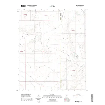
2018 Map of Mesa Parada
USGS Topo · Published 2018About this map
Mesa Parada rises as the central topographic landmark along the high desert border between Arizona and New Mexico. This 2018 survey documents a remote landscape defined by its essential water sources, including Gallegos Springs and a series of livestock tanks like White Tank and Tucker Tank. The drainage patterns of the high plateau are carved by the Cienega Amarilla and Carrizo Wash, which wind through the eastern side of the Apache and Catron county line.
Find a feature on this map
28 named features on this map. Tap any name to fly to it.
Don’t see what you’re looking for? This feature index may not catch every label — zoom into the map to look around manually.
Map Details
Editions of this 2018 Mesa Parada Map
This is the sole edition of this map. No revisions or reprints were ever made.
Other maps of this area

1886 · St Johns
USGS Topo · 1:250,000

1892 · St Johns
USGS Topo · 1:250,000

1954 · Saint Johns
USGS Topo · 1:250,000

1957 · Saint Johns
USGS Topo · 1:250,000

1958 · Saint Johns
USGS Topo · 1:250,000

1962 · Saint Johns
USGS Topo · 1:250,000

1971 · Mesa Parada NW
USGS Topo · 1:24,000

1971 · Mesa Parada
USGS Topo · 1:24,000
1971 · Voigt Ranch
USGS Topo · 1:24,000
1971 · The Rincon
USGS Topo · 1:24,000