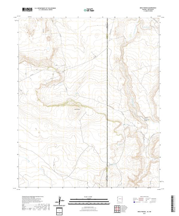
2021 Map of Mesa Parada
USGS Topo · Published 2021About this map
The high desert landscape along the border of Apache County, Arizona, and Catron County, New Mexico, is defined by the prominent Mesa Parada. This arid region relies on scattered water sources, including Gallegos Springs and seasonal drainages such as Carrizo Wash and Jarvis Wash. The terrain is deeply cut by the Cottonwood Canyon and features several man-made or natural catchments like White Tank, Tucker Tank, and Kelhinne Tank, which are essential for livestock and local wildlife. Surveyed in 2021, the map reveals a sparse network of county and local roads, such as Anazazi Rd and Catron Co Rd A001, which cross the state line. The presence of Cienega Amarilla suggests areas of seasonally wet meadow or marshland amidst the dryer draws like La Draw, highlighting the delicate hydrological balance of this borderland territory.
Find a feature on this map
27 named features on this map. Tap any name to fly to it.
Don’t see what you’re looking for? This feature index may not catch every label — zoom into the map to look around manually.
Map Details
Editions of this 2021 Mesa Parada Map
This is the sole edition of this map. No revisions or reprints were ever made.
Other maps of this area

1886 · St Johns
USGS Topo · 1:250,000

1892 · St Johns
USGS Topo · 1:250,000

1954 · Saint Johns
USGS Topo · 1:250,000

1957 · Saint Johns
USGS Topo · 1:250,000

1958 · Saint Johns
USGS Topo · 1:250,000

1962 · Saint Johns
USGS Topo · 1:250,000

1971 · Mesa Parada NW
USGS Topo · 1:24,000

1971 · Mesa Parada
USGS Topo · 1:24,000
1971 · Voigt Ranch
USGS Topo · 1:24,000
1971 · The Rincon
USGS Topo · 1:24,000