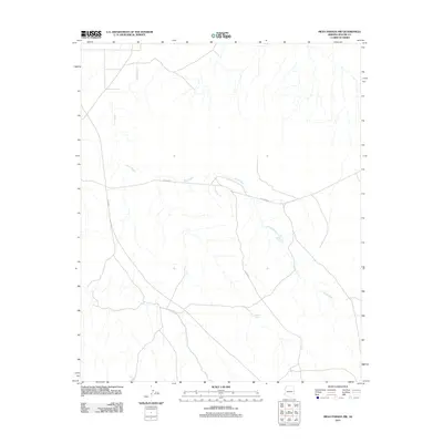
2011 Map of Mesa Parada NW
USGS Topo · Published 2011About this map
Jarvis Wash dominates the arid landscape of this Apache County region, carving its path through the open terrain. This drainage system is the primary geological feature of the area, supported by man-made water collection points like Upper Tank and Coulter Tank. These features indicate the importance of water management in a high-desert environment, likely serving local ranching or livestock interests. The area is intersected by a network of county roads, including Co RD 6040 and Co RD 6000, which provide the main transit routes through the sparse settlement. This 2011 survey provides a clear look at the modern rural infrastructure and natural drainage patterns before further development or landscape shifts.
Find a feature on this map
6 named features on this map. Tap any name to fly to it.
Don’t see what you’re looking for? This feature index may not catch every label — zoom into the map to look around manually.
Map Details
Editions of this 2011 Mesa Parada NW Map
This is the sole edition of this map. No revisions or reprints were ever made.
Other maps of this area

1886 · St Johns
USGS Topo · 1:250,000

1892 · St Johns
USGS Topo · 1:250,000

1954 · Saint Johns
USGS Topo · 1:250,000

1957 · Saint Johns
USGS Topo · 1:250,000

1958 · Saint Johns
USGS Topo · 1:250,000

1962 · Saint Johns
USGS Topo · 1:250,000

1971 · Mesa Parada NW
USGS Topo · 1:24,000

1971 · Mesa Parada
USGS Topo · 1:24,000
1971 · Voigt Ranch
USGS Topo · 1:24,000
1971 · The Rincon
USGS Topo · 1:24,000