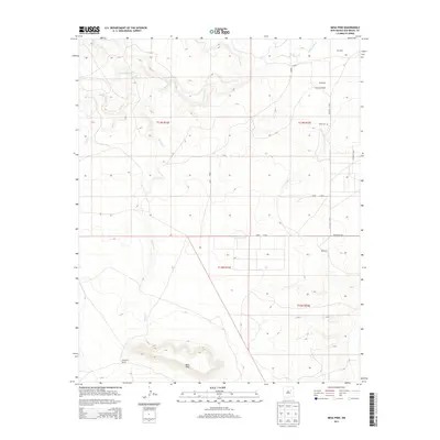
2013 Map of Mesa Pino
USGS Topo · Published 2013About this map
Mesa Pino anchors the southern landscape of this New Mexico quadrangle, where high desert elevations meet the drainage basins of the Conchas River. This early 21st-century survey documents a region defined by ranching heritage and water rights, marked by family-named landholdings such as Quintana Ranch and Thompson Ranch. These settlements are connected by a network of rural routes, including Co Road C-58-B and Co Road C-58-C, which follow the natural contours carved by Garita Cr and El Poso Cr. Genealogy researchers can identify localized points of interest such as the Sena Cem and the small communities of Quintana and Reymond, offering a snapshot of San Miguel County land use before contemporary development further altered the traditional rural character of the high plains.
Find a feature on this map
17 named features on this map. Tap any name to fly to it.
Don’t see what you’re looking for? This feature index may not catch every label — zoom into the map to look around manually.
Map Details
Editions of this 2013 Mesa Pino Map
This is the sole edition of this map. No revisions or reprints were ever made.
Other maps of this area

1892 · Corazon
USGS Topo · 1:125,000

1894 · Corazon
USGS Topo · 1:125,000

1954 · Santa Fe
USGS Topo · 1:250,000

1958 · Santa Fe
USGS Topo · 1:250,000

1963 · Mesa Cherisco
USGS Topo · 1:24,000
1963 · Bar Y Ranch
USGS Topo · 1:24,000

1963 · Mesita Del Gato
USGS Topo · 1:24,000

1972 · Variadero
USGS Topo · 1:24,000

1972 · La Silla
USGS Topo · 1:24,000
1972 · Cabra Hill
USGS Topo · 1:24,000