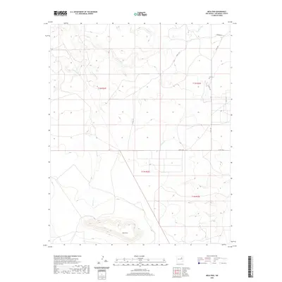
2020 Map of Mesa Pino
USGS Topo · Published 2020About this map
Mesa Pino rises as a prominent landform above the drainages of the Conchas River in this arid reach of San Miguel County. The landscape is defined by the convergence of several ephemeral waterways, including Garita Cr, Corazon Cr, and El Poso Cr, which carve through the high plains terrain. Human presence is sparse, marked primarily by a network of rural routes such as Co Rd C58B and Creek C-58-C. For those researching local family history or the early ranching footprints of the region, the Sena Cem stands as a significant cultural landmark in the northeastern portion of the sheet. The map effectively documents the transition from river bottoms to high mesas, showing the isolation and rugged geography characteristic of this part of New Mexico.
Find a feature on this map
14 named features on this map. Tap any name to fly to it.
Don’t see what you’re looking for? This feature index may not catch every label — zoom into the map to look around manually.
Map Details
Editions of this 2020 Mesa Pino Map
This is the sole edition of this map. No revisions or reprints were ever made.
Other maps of this area

1892 · Corazon
USGS Topo · 1:125,000

1894 · Corazon
USGS Topo · 1:125,000

1954 · Santa Fe
USGS Topo · 1:250,000

1958 · Santa Fe
USGS Topo · 1:250,000

1963 · Mesa Cherisco
USGS Topo · 1:24,000
1963 · Bar Y Ranch
USGS Topo · 1:24,000

1963 · Mesita Del Gato
USGS Topo · 1:24,000

1972 · Variadero
USGS Topo · 1:24,000

1972 · La Silla
USGS Topo · 1:24,000
1972 · Cabra Hill
USGS Topo · 1:24,000