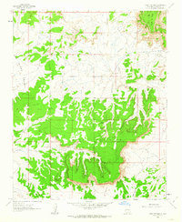
1961 Map of Mesa Portales
USGS Topo · Published 1963About this map
Mesa Portales and Mesa Chijuila dominate this high-desert landscape in Sandoval County, revealing a terrain defined by dramatic escarpments and seasonal watercourses. Mapped in the early 1960s, the area shows a reliance on scattered water sources such as Ojo de Gutierrez, Smoky Spring, and Moreno Spring. These springs and ojos, or "eyes" of water, are critical landmarks in the arid expanse of the San Isidro Valley, where travel and settlement historically followed the reliable flow of the canyons.
Find a feature on this map
20 named features on this map. Tap any name to fly to it.
Don’t see what you’re looking for? This feature index may not catch every label — zoom into the map to look around manually.
Map Details
Editions of this 1961 Mesa Portales Map
2 editions found
Other maps of this area

1883 · Mt. Taylor
USGS Topo · 1:250,000

1886 · Mt. Taylor
USGS Topo · 1:250,000

1889 · Largo
USGS Topo · 1:250,000

1890 · Jemes
USGS Topo · 1:125,000

1892 · Jemes
USGS Topo · 1:125,000

1892 · Mt. Taylor
USGS Topo · 1:250,000

1895 · Largo
USGS Topo · 1:250,000

1899 · Mt. Taylor
USGS Topo · 1:250,000

1909 · Gallina
USGS Topo · 1:125,000

1939 · La Ventana
USGS Topo · 1:62,500