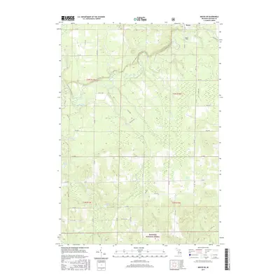
2017 Map of Mesick NE
USGS Topo · Published 2017About this map
The Manistee River winds through the northern half of this landscape, its path punctuated by Baxter Bridge near the small settlement of Baxter. The terrain is defined by a complex network of glacial hydrology, where numerous smaller streams like Filer Creek, Soper Cr, and Blind Cr feed into the larger river system. Significant protected acreage within the Manistee National Forest covers much of the southern and eastern portions of the map, preserving a landscape dense with kettle lakes including Carp Lake, Cedar Lake, and Ferguson Lake.
Find a feature on this map
56 named features on this map. Tap any name to fly to it.
Don’t see what you’re looking for? This feature index may not catch every label — zoom into the map to look around manually.
Map Details
Editions of this 2017 Mesick NE Map
This is the sole edition of this map. No revisions or reprints were ever made.
Other maps of this area

1954 · Traverse City
USGS Topo · 1:250,000

1956 · Fife Lake
USGS Topo · 1:62,500

1956 · Kingsley
USGS Topo · 1:62,500

1956 · Mesick
USGS Topo · 1:62,500

1956 · Cadillac North
USGS Topo · 1:62,500

1958 · Traverse City
USGS Topo · 1:250,000

1983 · Cadillac
USGS Topo · 1:100,000

1983 · Manton
USGS Topo · 1:25,000

1983 · Buckley
USGS Topo · 1:25,000

1983 · Cadillac North
USGS Topo · 1:24,000