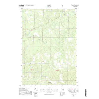
2019 Map of Mesick NE
USGS Topo · Published 2019About this map
The Manistee River winds through this section of Wexford County, defining a landscape of wetlands and forests within the Manistee National Forest. In the northern reaches, the small settlement of Baxter sits near the river crossing at Baxter Bridge, while the N Country National Scenic Trail meanders through the central woodlands. The topography is marked by numerous water bodies, including Cedar Lake, Twin Lakes, and Grassy Lakes, which likely supported local timber or recreational interests over the decades. Genealogists may find interest in the centrally located Soper Cem, situated near several small tributaries like Soper Cr and Adams Cr. The map reveals a transition between established forest service roads and more local grid routes such as W 4 Rd and N 27 Rd, illustrating the intersection of protected wilderness and rural access.
Find a feature on this map
54 named features on this map. Tap any name to fly to it.
Don’t see what you’re looking for? This feature index may not catch every label — zoom into the map to look around manually.
Map Details
Editions of this 2019 Mesick NE Map
This is the sole edition of this map. No revisions or reprints were ever made.
Other maps of this area

1954 · Traverse City
USGS Topo · 1:250,000

1956 · Fife Lake
USGS Topo · 1:62,500

1956 · Kingsley
USGS Topo · 1:62,500

1956 · Mesick
USGS Topo · 1:62,500

1956 · Cadillac North
USGS Topo · 1:62,500

1958 · Traverse City
USGS Topo · 1:250,000

1983 · Cadillac
USGS Topo · 1:100,000

1983 · Manton
USGS Topo · 1:25,000

1983 · Buckley
USGS Topo · 1:25,000

1983 · Cadillac North
USGS Topo · 1:24,000