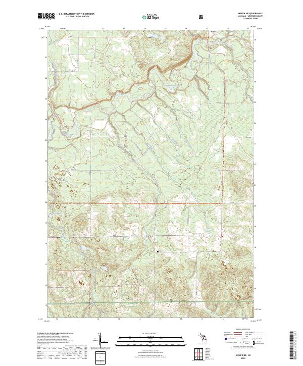
2023 Map of Mesick NE
USGS Topo · Published 2023About this map
The Manistee River and its numerous tributaries dominate this portion of the Manistee National Forest in Wexford County. The river winds through the northern half of the quadrangle, joined by waterways such as Soper Creek, Filer Creek, and Apple Creek. To the north, the small settlement of Baxter sits near the crossing of Silver Creek and the river. This area is characterized by a high density of small water bodies and wetlands, including Grassy Lakes, Twin Lakes, and Cedar Lake, illustrating the post-glacial landscape of Northern Michigan. For local historians and genealogists, the Soper Cem located off E 16 1/2 Rd provides a specific point of interest for family research. Modern recreational access is highlighted by the North Country National Scenic Trl, which traverses the river valley and forested uplands, connecting this landscape to a larger regional network.
Find a feature on this map
56 named features on this map. Tap any name to fly to it.
Don’t see what you’re looking for? This feature index may not catch every label — zoom into the map to look around manually.
Map Details
Editions of this 2023 Mesick NE Map
This is the sole edition of this map. No revisions or reprints were ever made.
Other maps of this area

1954 · Traverse City
USGS Topo · 1:250,000

1956 · Fife Lake
USGS Topo · 1:62,500

1956 · Kingsley
USGS Topo · 1:62,500

1956 · Mesick
USGS Topo · 1:62,500

1956 · Cadillac North
USGS Topo · 1:62,500

1958 · Traverse City
USGS Topo · 1:250,000

1983 · Cadillac
USGS Topo · 1:100,000

1983 · Manton
USGS Topo · 1:25,000

1983 · Buckley
USGS Topo · 1:25,000

1983 · Cadillac North
USGS Topo · 1:24,000