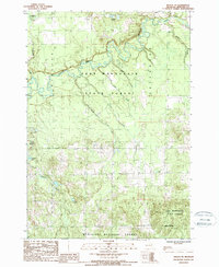
1987 Map of Mesick NE
USGS Topo · Published 1988About this map
The Manistee River meanders across this northern Michigan landscape, carving a prominent valley through the Pere Marquette State Forest. This mid-1980s survey documents a region dominated by conservation and public lands, including the northern boundary of the Manistee National Forest. The map reveals a complex drainage network where numerous smaller tributaries, such as Anderson Creek, Soper Creek, and Filer Creek, feed into the primary river system. Scattered across the wooded terrain are several small water bodies, including the Grassy Lakes in the north and Twin Lakes to the west. The layout of these forests and waterways illustrates the character of Wexford County's interior, showing how the State Forest Boundary defines the use of the land. Researchers can observe the density of the forest cover and the precise locations of secluded lakes like Ferguson Lake and Carp Lake, which remain largely buffered by protected state and federal lands.
Find a feature on this map
20 named features on this map. Tap any name to fly to it.
Don’t see what you’re looking for? This feature index may not catch every label — zoom into the map to look around manually.
Map Details
Editions of this 1987 Mesick NE Map
This is the sole edition of this map. No revisions or reprints were ever made.
Other maps of this area

1954 · Traverse City
USGS Topo · 1:250,000

1956 · Fife Lake
USGS Topo · 1:62,500

1956 · Kingsley
USGS Topo · 1:62,500

1956 · Mesick
USGS Topo · 1:62,500

1956 · Cadillac North
USGS Topo · 1:62,500

1958 · Traverse City
USGS Topo · 1:250,000

1983 · Cadillac
USGS Topo · 1:100,000

1983 · Manton
USGS Topo · 1:25,000

1983 · Buckley
USGS Topo · 1:25,000

1983 · Cadillac North
USGS Topo · 1:24,000