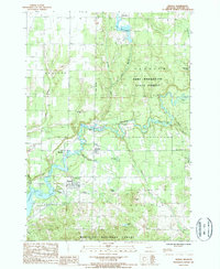
1987 Map of Mesick
USGS Topo · Published 1988About this map
The Manistee River carves a deep path through northwestern Michigan, defining the transition between the Pere Marquette State Forest to the north and the Manistee National Forest to the south. In the late 1980s, the village of Mesick stands as a local hub near the southern bank of the river, situated just east of the expansive Hodenpyl Dam Pond. This area is characterized by a high concentration of small lakes and creeks, including Lake Gitchegumee and Lake of the Woods, which are tucked into the undulating terrain.
Find a feature on this map
32 named features on this map. Tap any name to fly to it.
Don’t see what you’re looking for? This feature index may not catch every label — zoom into the map to look around manually.
Map Details
Editions of this 1987 Mesick Map
This is the sole edition of this map. No revisions or reprints were ever made.
Other maps of this area

1954 · Traverse City
USGS Topo · 1:250,000

1956 · Kingsley
USGS Topo · 1:62,500

1956 · Mesick
USGS Topo · 1:62,500

1956 · Thompsonville
USGS Topo · 1:62,500

1957 · Copemish
USGS Topo · 1:62,500

1958 · Traverse City
USGS Topo · 1:250,000

1976 · Thompsonville SE
USGS Topo · 1:24,000

1983 · Cadillac
USGS Topo · 1:100,000

1983 · Buckley
USGS Topo · 1:25,000

1983 · Traverse City
USGS Topo · 1:100,000