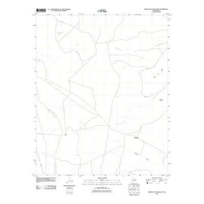
2010 Map of Mesita De Guadalupe
USGS Topo · Published 2010About this map
Moon Ranch sits at the center of this 2010 topographic study of the New Mexico landscape. The terrain is defined by dramatic geological formations, most notably the high plateau of Mesa del Medio and the distinctively flat-topped elevations of Mesita de Guadalupe and Mesita Cortada. The drainage system for this arid region is meticulously recorded through several intermittent channels, including the Cañada de Arriba, Cañada de Abajo, and Guadalupe Draw. Man-made water catchments such as Telephone Tank and Frog Tank underscore the vital importance of water management in this livestock-rearing territory. Modern access is facilitated by County Rd 4, which provides the primary connection through this portion of Guadalupe County.
Find a feature on this map
12 named features on this map. Tap any name to fly to it.
Don’t see what you’re looking for? This feature index may not catch every label — zoom into the map to look around manually.
Map Details
Editions of this 2010 Mesita De Guadalupe Map
This is the sole edition of this map. No revisions or reprints were ever made.
Other maps of this area

1890 · Bernal
USGS Topo · 1:125,000

1891 · Bernal
USGS Topo · 1:125,000

1892 · Corazon
USGS Topo · 1:125,000

1894 · Corazon
USGS Topo · 1:125,000

1894 · Bernal
USGS Topo · 1:125,000

1954 · Santa Fe
USGS Topo · 1:250,000

1954 · Fort Sumner
USGS Topo · 1:250,000

1958 · Fort Sumner
USGS Topo · 1:250,000

1958 · Santa Fe
USGS Topo · 1:250,000

1963 · Colonias
USGS Topo · 1:24,000