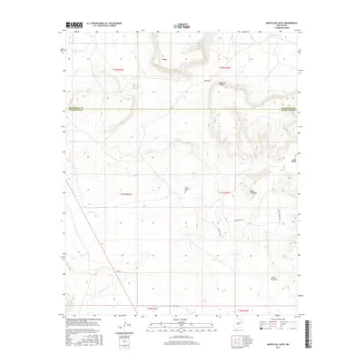
2017 Map of Mesita Del Gato
USGS Topo · Published 2017About this map
Monte Calvario Cem sits as a lonely landmark near the center of this high plateau landscape, north of Cherisco Cr and west of the winding Cuervo Cr. The terrain is defined by a series of distinct mesas and canyons, including the prominent Mesita del Gato in the southeast and the tiered levels of Mesa del Medio and Mesita del Medio. This 2017 survey by the U.S. Geological Survey details a remote area where the border of San Miguel County and Guadalupe County crosses the high ground of W Mesa. Drainage systems like Difrises Arroyo and Puerto Cr carve through the tablelands, while primitive routes such as Mesita Pass Rd and Webb Rd provide the only passage through the gaps, such as the notch at El Puerto.
Find a feature on this map
24 named features on this map. Tap any name to fly to it.
Don’t see what you’re looking for? This feature index may not catch every label — zoom into the map to look around manually.
Map Details
Editions of this 2017 Mesita Del Gato Map
This is the sole edition of this map. No revisions or reprints were ever made.
Other maps of this area

1892 · Corazon
USGS Topo · 1:125,000

1894 · Corazon
USGS Topo · 1:125,000

1954 · Santa Fe
USGS Topo · 1:250,000

1958 · Santa Fe
USGS Topo · 1:250,000

1963 · Mesa Cherisco
USGS Topo · 1:24,000

1963 · Sacaton Draw
USGS Topo · 1:24,000

1963 · Mesita Del Gato
USGS Topo · 1:24,000

1963 · Cuervo
USGS Topo · 1:24,000

1964 · Neafus Ranch
USGS Topo · 1:24,000

1964 · Newkirk
USGS Topo · 1:24,000