1964 Map of Newkirk
USGS Topo · Published 1967About this map
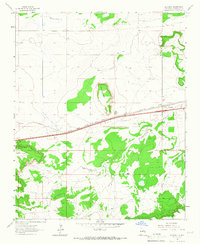
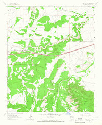
Newkirk serves as a small railroad-anchored settlement on the high plains of Guadalupe County, situated at a junction where the Southern Pacific and Chicago Rock Island and Pacific rail lines converge. The landscape is defined by the sharp elevations of Mesa del Gato and the expansive Cuervo Mesa, which overlook the winding drainage systems of Pajarito Creek and Difrises Arroyo. Evidence of the local cattle-ranching and industrial economy is seen in the placement of the Boylan Ranch and various gravel and borrow pits alongside the transportation corridor. Local history is anchored at the Newkirk Cem, providing a genealogical focal point for the families who settled this territory of east-central New Mexico.
Find a feature on this map
16 named features on this map. Tap any name to fly to it.
Don’t see what you’re looking for? This feature index may not catch every label — zoom into the map to look around manually.
Map Details
Editions of this 1964 Newkirk Map
This is the sole edition of this map. No revisions or reprints were ever made.
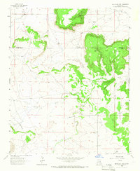
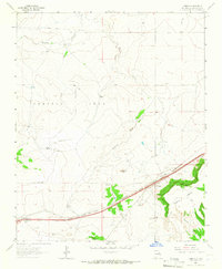
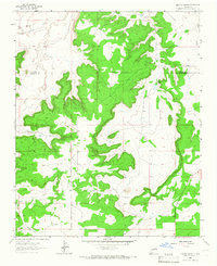
Other maps of this area

1954 · Santa Fe
USGS Topo · 1:250,000

1954 · Fort Sumner
USGS Topo · 1:250,000

1958 · Fort Sumner
USGS Topo · 1:250,000

1958 · Santa Fe
USGS Topo · 1:250,000
1963 · Mesita Del Gato
USGS Topo · 1:24,000
1963 · Cuervo
USGS Topo · 1:24,000
1964 · Neafus Ranch
USGS Topo · 1:24,000
1964 · Gate Canyon
USGS Topo · 1:24,000
1964 · Salt Lake
USGS Topo · 1:24,000
1964 · Harben Lake
USGS Topo · 1:24,000