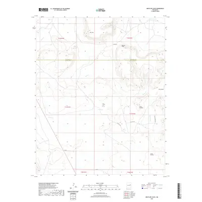
2020 Map of Mesita Del Gato
USGS Topo · Published 2020About this map
Monte Calvario Cem sits as a central landmark in this high-desert landscape, located near the headwaters of Cherisco Cr and Puerto Cr. The terrain is defined by a series of prominent mesas and escarpments, including West Mesa and the layered elevations of Mesa del Medio and Mesita del Medio. This 2020 survey documents the complex drainage systems of the Pecos River basin, where seasonal watercourses like Cuervo Cr and Little Cuervo Cr have carved the earth into distinct geological features such as Cahon Bonita. The southern portion of the quadrangle is anchored by the landform of Mesita del Gato, with access provided by rural routes like Mesita Pass Rd and Webb Rd. The map also traces the administrative boundary between San Miguel Co and Guadalupe Co, showing how political lines bisect these natural plateau formations.
Find a feature on this map
24 named features on this map. Tap any name to fly to it.
Don’t see what you’re looking for? This feature index may not catch every label — zoom into the map to look around manually.
Map Details
Editions of this 2020 Mesita Del Gato Map
This is the sole edition of this map. No revisions or reprints were ever made.
Other maps of this area

1892 · Corazon
USGS Topo · 1:125,000

1894 · Corazon
USGS Topo · 1:125,000

1954 · Santa Fe
USGS Topo · 1:250,000

1958 · Santa Fe
USGS Topo · 1:250,000

1963 · Mesa Cherisco
USGS Topo · 1:24,000

1963 · Sacaton Draw
USGS Topo · 1:24,000

1963 · Mesita Del Gato
USGS Topo · 1:24,000

1963 · Cuervo
USGS Topo · 1:24,000

1964 · Neafus Ranch
USGS Topo · 1:24,000

1964 · Newkirk
USGS Topo · 1:24,000