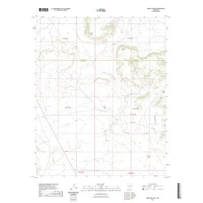
2023 Map of Mesita Del Gato
USGS Topo · Published 2023About this map
Monte Calvario Cem sits at the heart of this landscape, marking a site of local heritage near the transition from Puerto Creek to Cuervo Creek. The terrain is defined by a series of prominent elevations, notably Mesa Del Gato and its smaller counterpart, Mesita Del Gato, which anchor the southern half of the quadrangle. These flat-topped formations create a natural corridor through El Puerto, where drainage from Garita Creek and Cherisco Creek weaves around the base of West Mesa and Mesa Del Medio. The map illustrates a network of rural access routes, including Mesita Pass Rd and Webb Rd, which navigate the elevation changes between the high plateaus and the arroyos that segment the territory near the San Miguel and Guadalupe county line.
Find a feature on this map
23 named features on this map. Tap any name to fly to it.
Don’t see what you’re looking for? This feature index may not catch every label — zoom into the map to look around manually.
Map Details
Editions of this 2023 Mesita Del Gato Map
This is the sole edition of this map. No revisions or reprints were ever made.
Other maps of this area

1892 · Corazon
USGS Topo · 1:125,000

1894 · Corazon
USGS Topo · 1:125,000

1954 · Santa Fe
USGS Topo · 1:250,000

1958 · Santa Fe
USGS Topo · 1:250,000

1963 · Mesa Cherisco
USGS Topo · 1:24,000

1963 · Sacaton Draw
USGS Topo · 1:24,000

1963 · Mesita Del Gato
USGS Topo · 1:24,000

1963 · Cuervo
USGS Topo · 1:24,000

1964 · Neafus Ranch
USGS Topo · 1:24,000

1964 · Newkirk
USGS Topo · 1:24,000