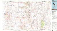
1985 Map of Mesquite Lake
USGS Topo · Published 1985About this map
Mining operations and dry lake beds define this arid borderland between California and Nevada. In the mid-1980s, the landscape was a complex grid of mineral extraction and transit, with the Union Pacific railroad and major highways cutting through the Ivanpah Valley. Notable historical markers such as the Von Schmidt Boundary trace the political divisions of the desert, while the East Mojave National Scenic Area indicates the transition toward large-scale land preservation. The region's industrial past is visible through a high concentration of silver, lead, and copper claims, including the Silver Rule Mine, Copper World Mine, and Hoosier Mine tucked into the mountain ranges. Small settlements like Sandy, Jean, and Borax serve as isolated outposts amidst the vast expanses of the Spring Mountains and the McCullough Range, where water sources like Stump Spring and Ninety-nine Spring provided essential lifelines for early travelers and prospectors.
Find a feature on this map
48 named features on this map. Tap any name to fly to it.
Don’t see what you’re looking for? This feature index may not catch every label — zoom into the map to look around manually.
Map Details
Editions of this 1985 Mesquite Lake Map
2 editions found
Other maps of this area

1886 · Camp Mohave
USGS Topo · 1:250,000

1886 · Saint Thomas
USGS Topo · 1:250,000

1892 · Camp Mohave
USGS Topo · 1:250,000

1893 · Saint Thomas
USGS Topo · 1:250,000

1907 · Las Vegas
USGS Topo · 1:250,000

1908 · Furnace Creek
USGS Topo · 1:250,000

1908 · Las Vegas
USGS Topo · 1:250,000

1910 · Furnace Creek
USGS Topo · 1:250,000

1910 · Ivanpah
USGS Topo · 1:250,000

1912 · Ivanpah
USGS Topo · 1:250,000