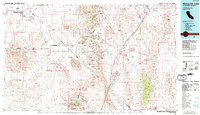
1985 Map of Mesquite Lake
USGS Topo · Published 1985About this map
Mining operations and transport corridors define this cross-border region as documented by the U.S. Geological Survey in the mid-1980s. The Spring Mountains are particularly dense with history, housing a concentration of mineral claims such as the Potosi Mine, Yellow Pine Mine, and the Shenandoah Mine. These sites reflect the extractive economy that fueled settlements like Goodsprings and Sandy. The landscape is a study in desert mobility, showing the path of the Old Spanish Trail alongside the modern Union Pacific railroad and the Von Schmidt Boundary.
Find a feature on this map
121 named features on this map. Tap any name to fly to it.
Don’t see what you’re looking for? This feature index may not catch every label — zoom into the map to look around manually.
Map Details
Editions of this 1985 Mesquite Lake Map
2 editions found
Other maps of this area

1886 · Camp Mohave
USGS Topo · 1:250,000

1886 · Saint Thomas
USGS Topo · 1:250,000

1892 · Camp Mohave
USGS Topo · 1:250,000

1893 · Saint Thomas
USGS Topo · 1:250,000

1907 · Las Vegas
USGS Topo · 1:250,000

1908 · Furnace Creek
USGS Topo · 1:250,000

1908 · Las Vegas
USGS Topo · 1:250,000

1910 · Furnace Creek
USGS Topo · 1:250,000

1910 · Ivanpah
USGS Topo · 1:250,000

1912 · Ivanpah
USGS Topo · 1:250,000