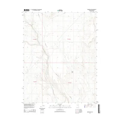
2014 Map of Mesquite NW
USGS Topo · Published 2014About this map
Toquop Wash snakes through the arid expanse of the Mojave Desert in this northeastern Nevada study, defining the drainage patterns of an open, alluvial landscape. The terrain is characterized by a network of ephemeral watercourses, including the S Fork Toquop Wash, which cut through the shifting sands and gravels typical of this desert environment. Human presence is sparse, marked primarily by utilitarian routes like Toquop Wash Rd and Camp Rd that provide access across the wide township and range divisions. The map reveals the intricate contouring of the desert floor and the surrounding ridges, illustrating the natural topographical barriers and conduits that dictate movement in Lincoln County. This survey serves as a clear record of the region’s undisturbed geography and the primitive road network that supports local travel through the desert interior.
Find a feature on this map
9 named features on this map. Tap any name to fly to it.
Don’t see what you’re looking for? This feature index may not catch every label — zoom into the map to look around manually.
Map Details
Editions of this 2014 Mesquite NW Map
This is the sole edition of this map. No revisions or reprints were ever made.
Other maps of this area

1885 · Pioche
USGS Topo · 1:250,000

1886 · Saint Thomas
USGS Topo · 1:250,000

1886 · Pioche
USGS Topo · 1:250,000

1893 · Saint Thomas
USGS Topo · 1:250,000

1954 · Caliente
USGS Topo · 1:250,000

1954 · Las Vegas
USGS Topo · 1:250,000

1957 · Las Vegas
USGS Topo · 1:250,000

1957 · Mesquite
USGS Topo · 1:62,500

1959 · Caliente
USGS Topo · 1:250,000

1959 · Las Vegas
USGS Topo · 1:250,000