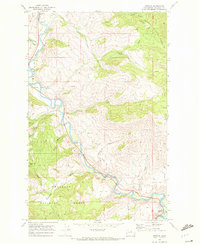
1968 Map of Methow
USGS Topo · Published 1972About this map
The Methow River carves a winding path through this portion of the Okanogan National Forest, defining the geography of the valley floor and its surrounding plateaus. In the late 1960s, the small settlements of Carlton and Methow served as the primary hubs in this reach of the river. The landscape is marked by distinct alluvial benches including Morse Flat, Mills Flat, and Cumbo Flat, which provided relatively level ground above the river channel. Higher elevations reveal a network of resource-driven activity, indicated by a Mine and Prospect tucked into the drainages of Texas Creek and Leecher Canyon. For those tracing historical land use, the map documents a system of remote infrastructure including a Footbridge over the main river and several named high-country features like McCall Basin and Vinegar Lake.
Find a feature on this map
35 named features on this map. Tap any name to fly to it.
Don’t see what you’re looking for? This feature index may not catch every label — zoom into the map to look around manually.
Map Details
Editions of this 1968 Methow Map
This is the sole edition of this map. No revisions or reprints were ever made.
Other maps of this area

1899 · Methow
USGS Topo · 1:125,000

1901 · Methow
USGS Topo · 1:125,000

1905 · Okanogan
USGS Topo · 1:125,000

1954 · Okanogan
USGS Topo · 1:250,000

1955 · Concrete
USGS Topo · 1:250,000

1956 · Loup Loup
USGS Topo · 1:62,500

1957 · Brewster
USGS Topo · 1:62,500

1958 · Concrete
USGS Topo · 1:250,000

1958 · Okanogan
USGS Topo · 1:250,000

1962 · Concrete
USGS Topo · 1:250,000