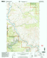
2001 Map of Methow
USGS Topo · Published 2004About this map
The Methow River flows south through this part of the valley, carving a path between the high ridgelines of the Okanogan National Forest. This 2001 revision highlights a landscape where settlement is concentrated along the riverbanks, notably at Carlton and Methow, while the surrounding terrain remains dominated by steep canyons and flat benches like Mills Flat and Morse Flat. The geography reveals a legacy of resource exploration, indicated by scattered Prospect sites and the Prospect Mine tucked into the hills north of Cow Creek.
Find a feature on this map
30 named features on this map. Tap any name to fly to it.
Don’t see what you’re looking for? This feature index may not catch every label — zoom into the map to look around manually.
Map Details
Editions of this 2001 Methow Map
This is the sole edition of this map. No revisions or reprints were ever made.
Other maps of this area

1899 · Methow
USGS Topo · 1:125,000

1901 · Methow
USGS Topo · 1:125,000

1905 · Okanogan
USGS Topo · 1:125,000

1954 · Okanogan
USGS Topo · 1:250,000

1955 · Concrete
USGS Topo · 1:250,000

1956 · Loup Loup
USGS Topo · 1:62,500

1957 · Brewster
USGS Topo · 1:62,500

1958 · Concrete
USGS Topo · 1:250,000

1958 · Okanogan
USGS Topo · 1:250,000

1962 · Concrete
USGS Topo · 1:250,000