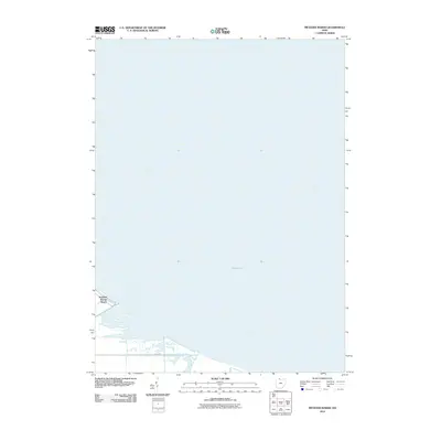
2010 Map of Metzger Marsh
USGS Topo · Published 2010About this map
Lake Erie dominates this coastal landscape in Ottawa County, where the shoreline transition reveals the low-lying wetlands and seasonal hydrology of the region. The map captures the southwestern corner of the lake near Howard Farms Beach, a localized residential settlement defined by its proximity to the water. Moving inland, the drainage patterns of Crane Creek illustrate the natural movement of water through the marshland before it meets the expansive lake. This area is characterized by a minimal road network, primarily focused on Veler Rd, which provides access to the shoreline communities. The survey reflects a specific moment in the early 21st century, showing how human development and natural aquatic systems interact along the Ohio lakefront.
Find a feature on this map
4 named features on this map. Tap any name to fly to it.
Don’t see what you’re looking for? This feature index may not catch every label — zoom into the map to look around manually.
Map Details
Editions of this 2010 Metzger Marsh Map
This is the sole edition of this map. No revisions or reprints were ever made.
Other maps of this area

1900 · Maumee Bay
USGS Topo · 1:62,500

1900 · Oak Harbor
USGS Topo · 1:62,500

1912 · Monroe
USGS Topo · 1:62,500

1914 · Monroe
USGS Topo · 1:62,500

1934 · Reno Beach
USGS Topo · 1:24,000

1935 · Genoa
USGS Topo · 1:24,000
1938 · Reno Beach
USGS Topo · 1:31,680
1938 · Genoa
USGS Topo · 1:31,680
1952 · Genoa
USGS Topo · 1:24,000

1952 · Oak Harbor
USGS Topo · 1:24,000