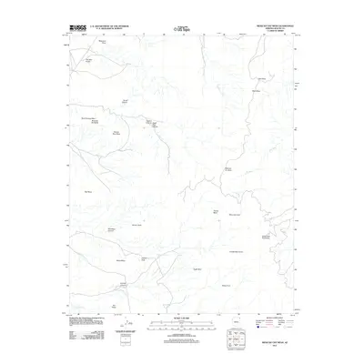
2011 Map of Mexican Cry Mesa
USGS Topo · Published 2011About this map
Mexican Cry Mesa and the rugged northern reaches of the Chuska Mountains define this high-desert landscape in Apache County. The map documents a territory where geological landmarks and seasonal water sources like White Hair Spring and Cow Spring have long served as vital orienting points. Named mesas and points, including Massacre Point and Rescue Rock Mesa, suggest a history etched into the land itself. The drainage patterns of Hasbidito Creek and Cove Wash carve through the terrain, connecting high features such as White Ash Peak to the deep recesses of Tzelena Canyon and Eagle Nest Canyon. This survey captures the topographical complexity of the Lukachukai Mountains boundary, showing a network of tracks and terrain features like Two Red Rocks and Female Rock that remain significant for navigation and land management within the Shiprock Agency region.
Find a feature on this map
28 named features on this map. Tap any name to fly to it.
Don’t see what you’re looking for? This feature index may not catch every label — zoom into the map to look around manually.
Map Details
Editions of this 2011 Mexican Cry Mesa Map
This is the sole edition of this map. No revisions or reprints were ever made.
Other maps of this area

1892 · Canyon De Chelly
USGS Topo · 1:250,000

1953 · Los Gigantes NE
USGS Topo · 1:24,000

1953 · Los Gigantes NW
USGS Topo · 1:24,000

1953 · Redrock Valley SW
USGS Topo · 1:24,000

1953 · Los Gigantes SE
USGS Topo · 1:24,000

1953 · Los Gigantes SW
USGS Topo · 1:24,000

1953 · Redrock Valley NW
USGS Topo · 1:24,000

1953 · Los Gigantes Buttes
USGS Topo · 1:62,500

1953 · Redrock Valley
USGS Topo · 1:62,500

1954 · Shiprock
USGS Topo · 1:250,000