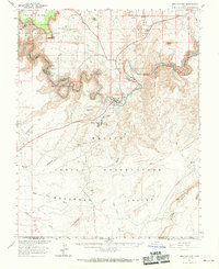
1963 Map of Mexican Hat
USGS Topo · Published 1969About this map
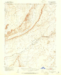
The San Juan River carves a deep, sinuous path through this high desert landscape, forming the tight meanders of the Goosenecks and the Second Narrows. To the north, the spires and monoliths of the Valley of the Gods rise below Cedar Mesa, while the southern half of the sheet is dominated by the Navajo Indian Reservation and the distinctive formations of Monument Valley.
Find a feature on this map
50 named features on this map. Tap any name to fly to it.
Don’t see what you’re looking for? This feature index may not catch every label — zoom into the map to look around manually.
Map Details
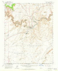
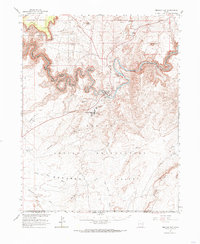
Editions of this 1963 Mexican Hat Map
3 editions found
Other maps of this area

1883 · Marsh Pass
USGS Topo · 1:250,000

1886 · Henry Mountains
USGS Topo · 1:250,000

1886 · Abajo
USGS Topo · 1:250,000

1892 · Marsh Pass
USGS Topo · 1:250,000

1892 · Abajo
USGS Topo · 1:250,000

1892 · Henry Mountains
USGS Topo · 1:250,000

1892 · Canyon De Chelly
USGS Topo · 1:250,000

1893 · Abajo
USGS Topo · 1:250,000
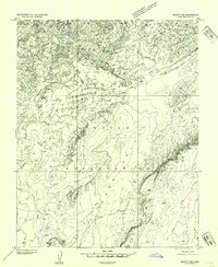
1952 · Bluff 3 SE
USGS Topo · 1:24,000
1952 · Dinnehotso
USGS Topo · 1:62,500