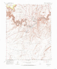
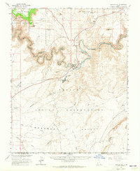
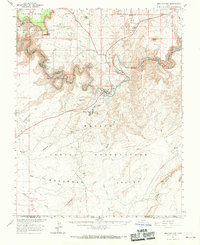
1963 Map of Mexican Hat
USGS Topo · Published 1985About this map
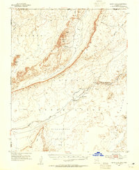
Mexican Hat and its surrounding canyonlands appear here in a survey published in cooperation with the Atomic Energy Commission. The landscape is defined by the winding course of the San Juan River, which carves the deep entrenchments of The Goosenecks and passes beneath landmarks like The Tabernacle and Alhambra Rock. Industrial activity of the early 1960s is evident near the settlement, where Tailings Ponds and a Gravel Pit suggest the era's uranium mining and infrastructure development.
Find a feature on this map
40 named features on this map. Tap any name to fly to it.
Don’t see what you’re looking for? This feature index may not catch every label — zoom into the map to look around manually.
Map Details
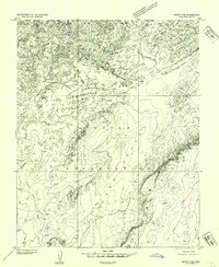
Editions of this 1963 Mexican Hat Map
3 editions found
Other maps of this area

1883 · Marsh Pass
USGS Topo · 1:250,000

1886 · Henry Mountains
USGS Topo · 1:250,000

1886 · Abajo
USGS Topo · 1:250,000

1892 · Marsh Pass
USGS Topo · 1:250,000

1892 · Abajo
USGS Topo · 1:250,000

1892 · Henry Mountains
USGS Topo · 1:250,000

1892 · Canyon De Chelly
USGS Topo · 1:250,000

1893 · Abajo
USGS Topo · 1:250,000
1952 · Bluff 3 SE
USGS Topo · 1:24,000
1952 · Dinnehotso
USGS Topo · 1:62,500