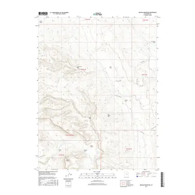
2017 Map of Mexican Mountain
USGS Topo · Published 2017About this map
Mexican Mountain and the dramatic geologic formations of the San Rafael Reef dominate this desert landscape in eastern Utah. The San Rafael River carves a deep path through the terrain, creating the sharp turn known as Mexican Bend and the narrow canyon of the Black Box. This area is marked by its isolation and the deep incisions of washes and draws, such as Cottonwood Wash and Tidwell Draw, which slice through the uplifted rock layers.
Find a feature on this map
26 named features on this map. Tap any name to fly to it.
Don’t see what you’re looking for? This feature index may not catch every label — zoom into the map to look around manually.
Map Details
Editions of this 2017 Mexican Mountain Map
This is the sole edition of this map. No revisions or reprints were ever made.
Other maps of this area

1885 · San Rafael
USGS Topo · 1:250,000

1886 · Price River
USGS Topo · 1:250,000

1896 · Price River
USGS Topo · 1:250,000

1953 · Red Plateau SE
USGS Topo · 1:24,000

1953 · Beckwith Peak SW
USGS Topo · 1:24,000

1953 · Tidwell 2 NW
USGS Topo · 1:24,000

1954 · Stinking Spring Creek 1 NE
USGS Topo · 1:24,000

1954 · Tidwell 2 NE
USGS Topo · 1:24,000

1954 · Tidwell Bottoms
USGS Topo · 1:62,500
1954 · The Wickiup
USGS Topo · 1:62,500