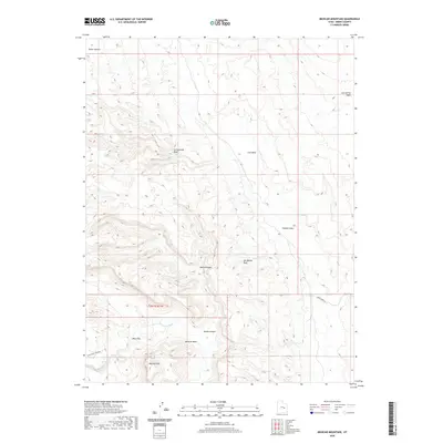
2020 Map of Mexican Mountain
USGS Topo · Published 2020About this map
Mexican Mtn and the sharp uplift of the San Rafael Reef define the intricate topography of this Emery County landscape. The San Rafael River carves a winding path through the southern half of the sheet, creating prominent hydrological landmarks like Mexican Bend and the deep gorge of the Black Box. The terrain is characterized by a network of drainage systems, including Cottonwood Wash and Lost Spring Wash, which cut through high-elevation features such as Horse Heaven and Calf Mesa. This 2020 survey documents the modern state of these desert landforms and the limited road network, including San Rafael River Rd and Smith Camp Rd, that provides access to the deep interior canyons like Nates Canyon and Spring Canyon.
Find a feature on this map
15 named features on this map. Tap any name to fly to it.
Don’t see what you’re looking for? This feature index may not catch every label — zoom into the map to look around manually.
Map Details
Editions of this 2020 Mexican Mountain Map
This is the sole edition of this map. No revisions or reprints were ever made.
Other maps of this area

1885 · San Rafael
USGS Topo · 1:250,000

1886 · Price River
USGS Topo · 1:250,000

1896 · Price River
USGS Topo · 1:250,000

1953 · Red Plateau SE
USGS Topo · 1:24,000

1953 · Beckwith Peak SW
USGS Topo · 1:24,000

1953 · Tidwell 2 NW
USGS Topo · 1:24,000

1954 · Stinking Spring Creek 1 NE
USGS Topo · 1:24,000

1954 · Tidwell 2 NE
USGS Topo · 1:24,000

1954 · Tidwell Bottoms
USGS Topo · 1:62,500
1954 · The Wickiup
USGS Topo · 1:62,500