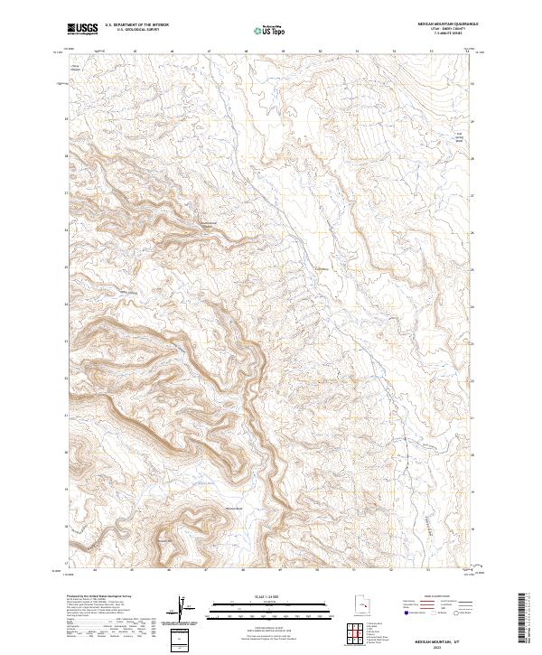
2023 Map of Mexican Mountain
USGS Topo · Published 2023About this map
The San Rafael River carves a sharp path through the southern reaches of this landscape, creating the dramatic oxbow at Mexican Bend just below the heights of Mexican Mountain. This desert terrain is defined by its drainage systems and high plateaus, including Horse Heaven in the northwest and Calf Mesa to the east. Transportation through this remote stretch of Emery County is limited to unimproved tracks like the San Rafael River Rd and Smith Camp Rd, highlighting the area's isolation. The map captures a complex network of seasonal watercourses, from the steep-walled Black Box to the expansive Cottonwood Wash and Tidwell Draw. These features, along with Nates Canyon and Spring Canyon, illustrate the rugged geological character of the San Rafael Swell's eastern flank.
Find a feature on this map
14 named features on this map. Tap any name to fly to it.
Don’t see what you’re looking for? This feature index may not catch every label — zoom into the map to look around manually.
Map Details
Editions of this 2023 Mexican Mountain Map
This is the sole edition of this map. No revisions or reprints were ever made.
Other maps of this area

1885 · San Rafael
USGS Topo · 1:250,000

1886 · Price River
USGS Topo · 1:250,000

1896 · Price River
USGS Topo · 1:250,000

1953 · Red Plateau SE
USGS Topo · 1:24,000

1953 · Beckwith Peak SW
USGS Topo · 1:24,000

1953 · Tidwell 2 NW
USGS Topo · 1:24,000

1954 · Stinking Spring Creek 1 NE
USGS Topo · 1:24,000

1954 · Tidwell 2 NE
USGS Topo · 1:24,000

1954 · Tidwell Bottoms
USGS Topo · 1:62,500
1954 · The Wickiup
USGS Topo · 1:62,500