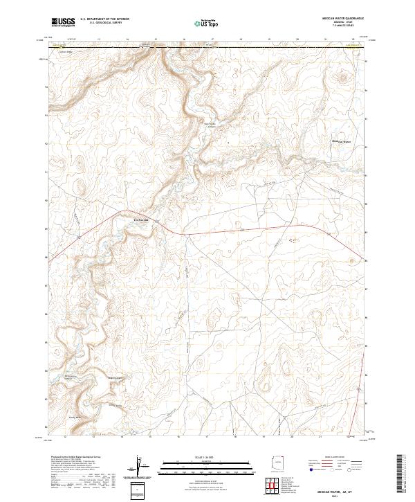
2021 Map of Mexican Water
USGS Topo · Published 2021About this map
Mexican Water and Tes Nez Iah serve as the primary focal points of this arid plateau landscape, situated near the Arizona and Utah border. The area is defined by the complex drainage network of Chinle Creek and the Chinle Wash, which carve through the high-desert terrain. These waterways, along with Walker Creek and Laguna Creek, provide the fundamental structure for movement and settlement in this part of Apache County. The topography is marked by distinctive formations such as Garnet Ridge, Skinny Mesa, and the deep incisions of Short Grass Canyon and Dennehotso Canyon. A network of local infrastructure, including Indian Rte 119 and Indian Rte 5053, connects these scattered settlements across the broad Chinle Valley. The map records a specific moment in the management of these tribal lands, where the natural canyons like Wagon Canyon dictate the path of travel through the Four Corners region.
Find a feature on this map
26 named features on this map. Tap any name to fly to it.
Don’t see what you’re looking for? This feature index may not catch every label — zoom into the map to look around manually.
Map Details
Editions of this 2021 Mexican Water Map
This is the sole edition of this map. No revisions or reprints were ever made.
Other maps of this area

1886 · Abajo
USGS Topo · 1:250,000

1892 · Abajo
USGS Topo · 1:250,000

1892 · Canyon De Chelly
USGS Topo · 1:250,000

1893 · Abajo
USGS Topo · 1:250,000

1952 · Bluff 3 SE
USGS Topo · 1:24,000

1952 · Dinnehotso
USGS Topo · 1:62,500

1952 · Setsiltso Springs 2 SE
USGS Topo · 1:24,000

1952 · Setsiltso Springs 2 NE
USGS Topo · 1:24,000

1954 · Shiprock
USGS Topo · 1:250,000

1956 · Cortez
USGS Topo · 1:250,000
Featured Places
- Shiprock Agency
- Tes Nez Iah, Shiprock Agency
- Mexican Water, Shiprock Agency
- Apache County, AZ
- San Juan County, UT