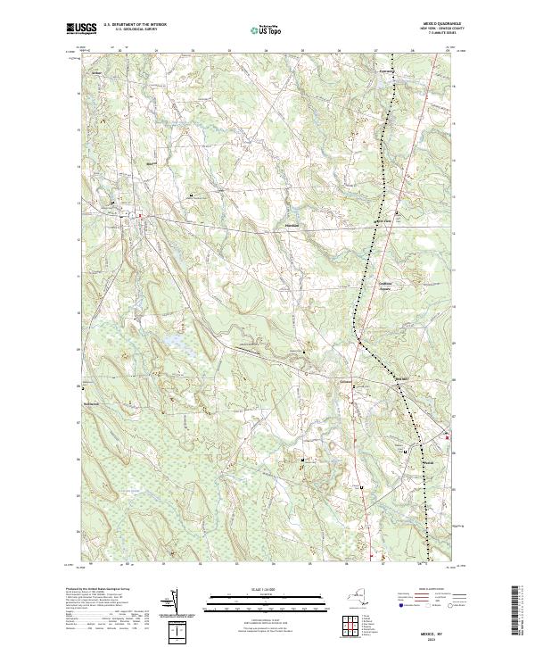
2023 Map of Mexico
USGS Topo · Published 2023About this map
The Little Salmon River and its various branches create a complex network of waterways across this part of Oswego County, defining the landscape around Mexico and Parish. The area maintains a rural character dominated by agricultural land and significant wetland features like Lot Ten Swamp in the south and the marshy expanses surrounding Sage Creek. The settlement pattern follows a traditional road network, with small hubs at Prattham, Colosse, and Maple View serving as local landmarks.
Find a feature on this map
110 named features on this map. Tap any name to fly to it.
Don’t see what you’re looking for? This feature index may not catch every label — zoom into the map to look around manually.
Map Details
Editions of this 2023 Mexico Map
This is the sole edition of this map. No revisions or reprints were ever made.
Other maps of this area

1895 · Pulaski
USGS Topo · 1:62,500

1900 · Fulton
USGS Topo · 1:62,500

1905 · Mexico
USGS Topo · 1:62,500

1943 · Pulaski
USGS Topo · 1:31,680

1943 · New Haven
USGS Topo · 1:31,680

1943 · Richland
USGS Topo · 1:31,680
1943 · Mallory
USGS Topo · 1:31,680

1943 · Texas
USGS Topo · 1:31,680

1943 · Mexico
USGS Topo · 1:31,680

1943 · Pennellville
USGS Topo · 1:31,680