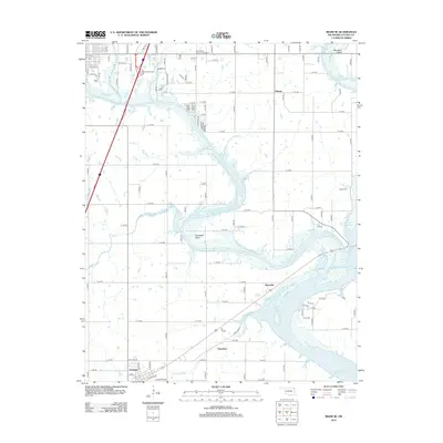
2012 Map of Miami SE
USGS Topo · Published 2012About this map
Grand Lake O' the Cherokees dominates the landscape southeast of Miami, where the waters wind through prominent geographical features like Mudeater Bend and Moccasin Bend. This region of Ottawa County is defined by a transition from the structured residential outskirts of Miami to the more rural, creek-carved plains. Several distinct settlements and historical landmarks are documented, including the communities of Ottawa, Moreville, and Ogeechee, alongside the southern town of Fairland near the junction of Railway Ave.
Find a feature on this map
48 named features on this map. Tap any name to fly to it.
Don’t see what you’re looking for? This feature index may not catch every label — zoom into the map to look around manually.
Map Details
Editions of this 2012 Miami SE Map
This is the sole edition of this map. No revisions or reprints were ever made.
Other maps of this area

1907 · Wyandotte
USGS Topo · 1:125,000

1909 · Wyandotte
USGS Topo · 1:125,000

1954 · Tulsa
USGS Topo · 1:250,000

1958 · Tulsa
USGS Topo · 1:250,000
1960 · Peoria
USGS Topo · 1:24,000

1961 · Miami SE
USGS Topo · 1:24,000
1961 · Miami NW
USGS Topo · 1:24,000

1961 · Wyandotte
USGS Topo · 1:24,000

1961 · Miami SW
USGS Topo · 1:24,000
1961 · Picher
USGS Topo · 1:24,000