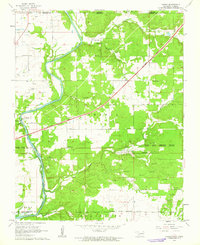
1960 Map of Peoria
USGS Topo · Published 1963About this map
Peoria anchors the eastern landscape of Ottawa County in this 1960 survey, a region defined by its overlapping indigenous reservation boundaries and the industrial legacy of the Tri-State district. The map meticulously delineates several tribal borders, including the Peoria Indian Reservation Boundary, as well as lands for the East Shawnee, Modoc, and Wyandotte nations. The terrain is deeply marked by extractive industry, visible through a high concentration of Tripoli Mines scattered across the eastern hills.
Find a feature on this map
35 named features on this map. Tap any name to fly to it.
Don’t see what you’re looking for? This feature index may not catch every label — zoom into the map to look around manually.
Map Details
Editions of this 1960 Peoria Map
2 editions found
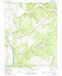
Other maps of this area

1886 · Joplin
USGS Topo · 1:125,000

1894 · Joplin
USGS Topo · 1:125,000

1907 · Wyandotte
USGS Topo · 1:125,000

1909 · Wyandotte
USGS Topo · 1:125,000

1918 · Columbus
USGS Topo · 1:62,500

1947 · Joplin
USGS Topo · 1:250,000

1949 · Joplin
USGS Topo · 1:250,000

1949 · Seneca
USGS Topo · 1:24,000

1949 · Racine
USGS Topo · 1:24,000

1950 · Seneca
USGS Topo · 1:24,000