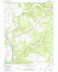
1960 Map of Peoria
USGS Topo · Published 1982About this map
The Peoria mining district and the intersection of multiple tribal reservations define this landscape in the northeast corner of Oklahoma. Extensive Tripoli Mines and industrial Tailings characterize the terrain south of Devils Hollow, highlighting a period of intense subsurface mineral extraction. The map documents a complex tapestry of territorial boundaries, including the Quapaw Indian Reservation Boundary, Peoria Indian Reservation Boundary, and Modoc Indian Reservation Boundary, which converge across the rolling hills of Peoria Prairie. To the west, the Spring River flows toward Lake O' the Cherokees, spanned by the Devils Promenade Bridge. Cultural landmarks like the Sunnyside Sch, Cherry Grove Ch, and Peoria Cem provide vital reference points for genealogists tracing families in this multi-jurisdictional borderland near the Kansas state line.
Find a feature on this map
39 named features on this map. Tap any name to fly to it.
Don’t see what you’re looking for? This feature index may not catch every label — zoom into the map to look around manually.
Map Details
Editions of this 1960 Peoria Map
2 editions found
Other maps of this area

1886 · Joplin
USGS Topo · 1:125,000

1894 · Joplin
USGS Topo · 1:125,000

1907 · Wyandotte
USGS Topo · 1:125,000

1909 · Wyandotte
USGS Topo · 1:125,000

1918 · Columbus
USGS Topo · 1:62,500

1947 · Joplin
USGS Topo · 1:250,000

1949 · Joplin
USGS Topo · 1:250,000

1949 · Seneca
USGS Topo · 1:24,000

1949 · Racine
USGS Topo · 1:24,000

1950 · Seneca
USGS Topo · 1:24,000