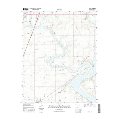
2016 Map of Miami SE
USGS Topo · Published 2016About this map
The Neosho River and Spring River converge in this northeastern Oklahoma landscape, feeding the northern reaches of Grand Lake O' the Cherokees. The river system defines the local geography, creating distinctive landforms such as Mudeater Bend and Moccasin Bend. To the northwest, the edge of Miami is visible along Tar Creek, while smaller communities like Ottawa, Moreville, and Ogeechee are distributed across the rural road grid.
Find a feature on this map
83 named features on this map. Tap any name to fly to it.
Don’t see what you’re looking for? This feature index may not catch every label — zoom into the map to look around manually.
Map Details
Editions of this 2016 Miami SE Map
This is the sole edition of this map. No revisions or reprints were ever made.
Other maps of this area

1907 · Wyandotte
USGS Topo · 1:125,000

1909 · Wyandotte
USGS Topo · 1:125,000

1954 · Tulsa
USGS Topo · 1:250,000

1958 · Tulsa
USGS Topo · 1:250,000
1960 · Peoria
USGS Topo · 1:24,000

1961 · Miami SE
USGS Topo · 1:24,000
1961 · Miami NW
USGS Topo · 1:24,000

1961 · Wyandotte
USGS Topo · 1:24,000

1961 · Miami SW
USGS Topo · 1:24,000
1961 · Picher
USGS Topo · 1:24,000