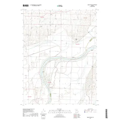
2017 Map of Miami Station
USGS Topo · Published 2017About this map
The Missouri River carves a sweeping path along the border of Carroll and Saline Counties, defining a landscape of complex hydrology and riverine bends. This 2017 survey documents the modern state of the river's dynamic course, highlighting major geographic features like Prunty Bend, Teteseau Bend, and Thomas Bend. The bottomlands are marked by secondary water systems such as Wakenda Creek, Van Meter Ditch, and the standing waters of Teteseau Lake and Lake Wooldridge.
Find a feature on this map
73 named features on this map. Tap any name to fly to it.
Don’t see what you’re looking for? This feature index may not catch every label — zoom into the map to look around manually.
Map Details
Editions of this 2017 Miami Station Map
This is the sole edition of this map. No revisions or reprints were ever made.
Other maps of this area

1890 · Marshall
USGS Topo · 1:125,000

1892 · Marshall
USGS Topo · 1:125,000

1901 · Marshall
USGS Topo · 1:125,000

1940 · Marshall
USGS Topo · 1:62,500

1944 · Marshall
USGS Topo · 1:62,500

1951 · Bosworth
USGS Topo · 1:24,000

1951 · Miami
USGS Topo · 1:24,000

1951 · Brunswick West
USGS Topo · 1:24,000

1951 · Miami Station
USGS Topo · 1:24,000

1951 · Carrollton East
USGS Topo · 1:24,000