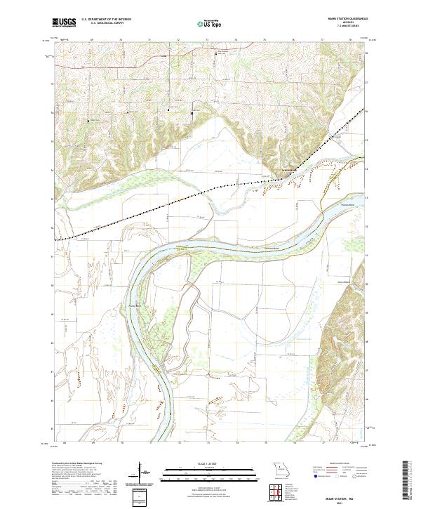
2021 Map of Miami Station
USGS Topo · Published 2021About this map
The Missouri River serves as the dividing line between Carroll and Saline Counties in this riverfront landscape. The northern bank is characterized by the meandering path of Wakenda Creek and the settlement at Miami Station, while the higher ground to the north is dotted with numerous small family and community burial grounds, including Salem Cem, Adkins Cem, and New Pleasant Park Cem. These landmarks reflect the long-standing agricultural roots of rural communities like Leta and White Rock.
Find a feature on this map
73 named features on this map. Tap any name to fly to it.
Don’t see what you’re looking for? This feature index may not catch every label — zoom into the map to look around manually.
Map Details
Editions of this 2021 Miami Station Map
This is the sole edition of this map. No revisions or reprints were ever made.
Other maps of this area

1890 · Marshall
USGS Topo · 1:125,000

1892 · Marshall
USGS Topo · 1:125,000

1901 · Marshall
USGS Topo · 1:125,000

1940 · Marshall
USGS Topo · 1:62,500

1944 · Marshall
USGS Topo · 1:62,500

1951 · Bosworth
USGS Topo · 1:24,000

1951 · Miami
USGS Topo · 1:24,000

1951 · Brunswick West
USGS Topo · 1:24,000

1951 · Miami Station
USGS Topo · 1:24,000

1951 · Carrollton East
USGS Topo · 1:24,000