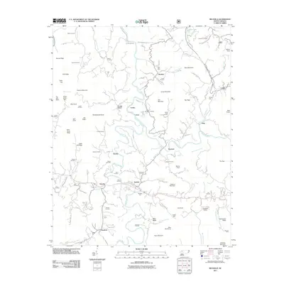
2011 Map of Micaville
USGS Topo · Published 2011About this map
Micaville and the winding course of the North Toe River anchor this 2011 survey, showing a landscape defined by industrial activity and deep-rooted family history. The region's mineral heritage is prominent at the Sink Hole Mine and Hootowl Mine, alongside modern water management at Deneen Dam. Numerous crossroads and small settlements like Double Island, Kona, and Bandana are connected by a network of winding roads such as Roses Branch Rd and Johnson Hollow Rd.
Find a feature on this map
111 named features on this map. Tap any name to fly to it.
Don’t see what you’re looking for? This feature index may not catch every label — zoom into the map to look around manually.
Map Details
Editions of this 2011 Micaville Map
This is the sole edition of this map. No revisions or reprints were ever made.
Other maps of this area

1891 · Roan Mountain
USGS Topo · 1:125,000

1894 · Roan Mountain
USGS Topo · 1:125,000

1900 · Mount Mitchell
USGS Topo · 1:125,000

1902 · Mount Mitchell
USGS Topo · 1:125,000

1904 · Roan Mountain
USGS Topo · 1:125,000

1934 · Micaville
USGS Topo · 1:24,000

1934 · Spruce Pine
USGS Topo · 1:24,000

1934 · Parts Of Celo And Black Brothers
USGS Topo · 1:24,000

1934 · Bakersville
USGS Topo · 1:24,000
1934 · Carvers Gap
USGS Topo · 1:24,000