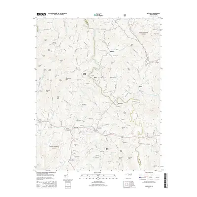
2016 Map of Micaville
USGS Topo · Published 2016About this map
Micaville and Newdale anchor the southern corridor of this Mitchell and Yancey County landscape, where the South Toe River and North Toe River carve through high-elevation terrain. The map documents a dense network of family heritage sites, including numerous cemeteries such as Riddle Cem, Hughes Cem, and Woody Cem that speak to the deep-rooted settlement history of the region.
Find a feature on this map
174 named features on this map. Tap any name to fly to it.
Don’t see what you’re looking for? This feature index may not catch every label — zoom into the map to look around manually.
Map Details
Editions of this 2016 Micaville Map
This is the sole edition of this map. No revisions or reprints were ever made.
Other maps of this area

1891 · Roan Mountain
USGS Topo · 1:125,000

1894 · Roan Mountain
USGS Topo · 1:125,000

1900 · Mount Mitchell
USGS Topo · 1:125,000

1902 · Mount Mitchell
USGS Topo · 1:125,000

1904 · Roan Mountain
USGS Topo · 1:125,000

1934 · Micaville
USGS Topo · 1:24,000

1934 · Spruce Pine
USGS Topo · 1:24,000

1934 · Parts Of Celo And Black Brothers
USGS Topo · 1:24,000

1934 · Bakersville
USGS Topo · 1:24,000
1934 · Carvers Gap
USGS Topo · 1:24,000