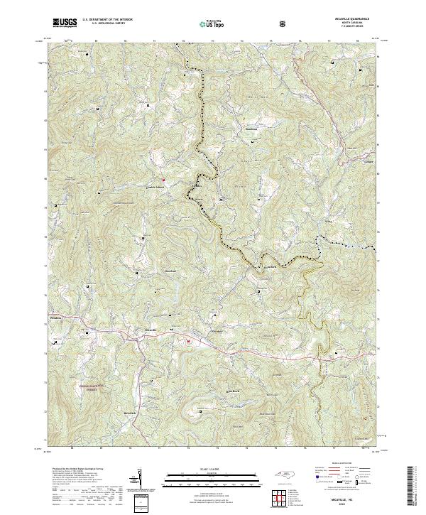
2022 Map of Micaville
USGS Topo · Published 2022About this map
The North Toe River and South Toe River carve through the mountains of Yancey and Mitchell counties, anchoring a network of small settlements and family-named landmarks. High elevations are defined by prominent peaks like Thunderstruck Knob, Gouge Mtn, and Blue Rock Knob, while the valleys host historic communities such as Micaville, Kona, and Bandana. The map reveals a deeply rooted landscape of ancestral burial grounds, including the Thomas Cem, Buchanan Cem, and Rebels Creek Cem, reflecting the area's long-standing genealogical significance.
Find a feature on this map
129 named features on this map. Tap any name to fly to it.
Don’t see what you’re looking for? This feature index may not catch every label — zoom into the map to look around manually.
Map Details
Editions of this 2022 Micaville Map
This is the sole edition of this map. No revisions or reprints were ever made.
Other maps of this area

1891 · Roan Mountain
USGS Topo · 1:125,000

1894 · Roan Mountain
USGS Topo · 1:125,000

1900 · Mount Mitchell
USGS Topo · 1:125,000

1902 · Mount Mitchell
USGS Topo · 1:125,000

1904 · Roan Mountain
USGS Topo · 1:125,000

1934 · Micaville
USGS Topo · 1:24,000

1934 · Spruce Pine
USGS Topo · 1:24,000

1934 · Parts Of Celo And Black Brothers
USGS Topo · 1:24,000

1934 · Bakersville
USGS Topo · 1:24,000
1934 · Carvers Gap
USGS Topo · 1:24,000