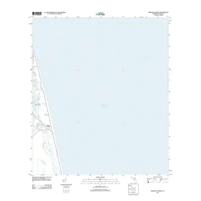
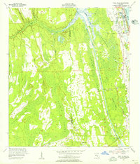
2012 Map of Mickler Landing
USGS Topo · Published 2012About this map
Mickler Landing and the coastal barrier landscape of Saint Johns County are defined by a narrow strip of development positioned between the vast Atlantic Ocean and the inland waters of the Guana River. This 2012 survey captures a transition point in Florida's northeastern shoreline, where suburban residential networks like Seawalk Dr and Isle Way Ln meet the coastal ecology of Diego Plains. To the south, Lake Ponte Vedra dominates the hydrography, separated from the beach by a thin dune line. The map illustrates how local infrastructure, including Mickler Rd and Neck Rd, navigates this slender corridor of land, providing a precise record of late-twentieth and early-twenty-first-century coastal planning and shoreline preservation in the region.
Find a feature on this map
12 named features on this map. Tap any name to fly to it.
Don’t see what you’re looking for? This feature index may not catch every label — zoom into the map to look around manually.
Map Details
Editions of this 2012 Mickler Landing Map
This is the sole edition of this map. No revisions or reprints were ever made.
Other maps of this area

1918 · Palm Valley
USGS Topo · 1:62,500

1918 · Mayport
USGS Topo · 1:62,500

1948 · Jacksonville
USGS Topo · 1:250,000

1948 · Jacksonville Beach
USGS Topo · 1:24,000

1949 · Jacksonville Beach
USGS Topo · 1:24,000
1952 · South Ponte Vedra Beach
USGS Topo · 1:24,000
1952 · Durbin
USGS Topo · 1:24,000
1952 · Mickler Landing
USGS Topo · 1:24,000
1952 · Palm Valley
USGS Topo · 1:24,000

1957 · Jacksonville
USGS Topo · 1:250,000