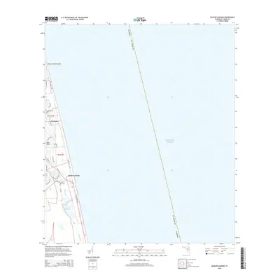
2015 Map of Mickler Landing
USGS Topo · Published 2015About this map
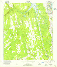
Ponte Vedra Beach and the planned communities of Sawgrass occupy this narrow coastal stretch between the Atlantic Ocean and the inland marshlands. This modern topographical study illustrates the dense residential development along the shoreline, characterized by a complex network of private drives and lagoons. South of Diego Plains, the landscape transitions to more preserved aquatic environments near Mickler Landing, where Lake Ponte Vedra and the Guana River run parallel to the coast. The map highlights the primary north-south transit corridor of Sr A1a N and Ponte Vedra Blvd, which serve as the lifelines for these seaside neighborhoods and the various private clubs and golf courses that define the local land use.
Find a feature on this map
28 named features on this map. Tap any name to fly to it.
Don’t see what you’re looking for? This feature index may not catch every label — zoom into the map to look around manually.
Map Details
Editions of this 2015 Mickler Landing Map
This is the sole edition of this map. No revisions or reprints were ever made.
Other maps of this area

1918 · Palm Valley
USGS Topo · 1:62,500

1918 · Mayport
USGS Topo · 1:62,500

1948 · Jacksonville
USGS Topo · 1:250,000

1948 · Jacksonville Beach
USGS Topo · 1:24,000

1949 · Jacksonville Beach
USGS Topo · 1:24,000
1952 · South Ponte Vedra Beach
USGS Topo · 1:24,000
1952 · Durbin
USGS Topo · 1:24,000
1952 · Mickler Landing
USGS Topo · 1:24,000
1952 · Palm Valley
USGS Topo · 1:24,000

1957 · Jacksonville
USGS Topo · 1:250,000