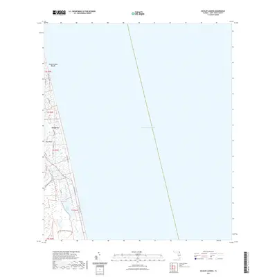
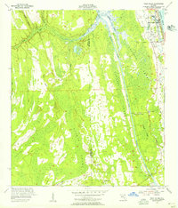
2021 Map of Mickler Landing
USGS Topo · Published 2021About this map
Ponte Vedra Beach and the planned community of Sawgrass occupy a narrow coastal strip between the Atlantic Ocean and the intricate marshlands of the Florida coast. This modern survey illustrates the dense residential development and golf course corridors of the Diego Plains area, contrasting sharply with the preserved wetlands of the Guana River Wildlife Management Area to the south. The geography is defined by a series of north-south barriers, including the primary thoroughfare of Ponte Vedra Blvd and the long, linear span of Lake Ponte Vedra. Moving inland, older residential routes like Neck Rd and Mickler Rd provide access to the interior waterways of the Guano River, showcasing the region's transition from open wetlands to highly structured coastal living.
Find a feature on this map
21 named features on this map. Tap any name to fly to it.
Don’t see what you’re looking for? This feature index may not catch every label — zoom into the map to look around manually.
Map Details
Editions of this 2021 Mickler Landing Map
This is the sole edition of this map. No revisions or reprints were ever made.
Other maps of this area

1918 · Palm Valley
USGS Topo · 1:62,500

1918 · Mayport
USGS Topo · 1:62,500

1948 · Jacksonville
USGS Topo · 1:250,000

1948 · Jacksonville Beach
USGS Topo · 1:24,000

1949 · Jacksonville Beach
USGS Topo · 1:24,000
1952 · South Ponte Vedra Beach
USGS Topo · 1:24,000
1952 · Durbin
USGS Topo · 1:24,000
1952 · Mickler Landing
USGS Topo · 1:24,000
1952 · Palm Valley
USGS Topo · 1:24,000

1957 · Jacksonville
USGS Topo · 1:250,000