
1968 Map of Middendorf
USGS Topo · Published 1970About this map
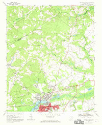
Carolina Sandhills dominate this portion of Chesterfield County, where the landscape is defined by the conservation efforts of the Carolina Sandhills National Wildlife Refuge and the Sandhills State Forest. The geography is shaped by a dense network of tributaries including Alligator Creek, Black Creek, and Lightwood Log Creek, which feed numerous managed water bodies such as Lake Bee and Martin Lake. This late 1960s environment shows a distinct contrast between the protected wildlife habitats and the industrial presence of several claypits and a sandpit near the southern boundary.
Find a feature on this map
56 named features on this map. Tap any name to fly to it.
Don’t see what you’re looking for? This feature index may not catch every label — zoom into the map to look around manually.
Map Details
Editions of this 1968 Middendorf Map
This is the sole edition of this map. No revisions or reprints were ever made.
Other maps of this area

1941 · Spartanburg
USGS Topo · 1:250,000

1953 · Spartanburg
USGS Topo · 1:250,000

1960 · Spartanburg
USGS Topo · 1:250,000

1963 · Spartanburg
USGS Topo · 1:250,000

1964 · Spartanburg
USGS Topo · 1:250,000

1967 · Angelus
USGS Topo · 1:24,000

1968 · Chesterfield
USGS Topo · 1:24,000

1968 · Patrick
USGS Topo · 1:24,000

1968 · Ruby
USGS Topo · 1:24,000
1968 · Hartsville North
USGS Topo · 1:24,000