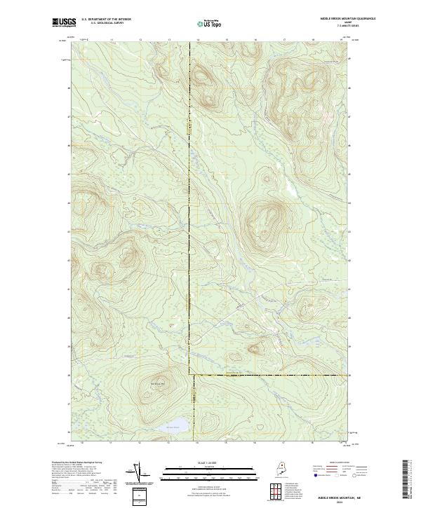
2024 Map of Middle Brook Mountain
USGS Topo · Published 2024About this map
Mooseleuk Stream carves a central path through this northern wilderness where the borders of Aroostook, Piscataquis, and Penobscot counties meet. The landscape is defined by its complex drainage network, featuring the convergence of Chandler Stream and Rocky Brook as they feed into the main waterway. This modern survey illustrates a territory managed for timber and conservation, dominated by the prominent elevation of Mid Brook Mtn and the tranquil Brown Pond at its southern base.
Find a feature on this map
24 named features on this map. Tap any name to fly to it.
Don’t see what you’re looking for? This feature index may not catch every label — zoom into the map to look around manually.
Map Details
Editions of this 2024 Middle Brook Mountain Map
This is the sole edition of this map. No revisions or reprints were ever made.
Other maps of this area

1930 · Greenlaw
USGS Topo · 1:48,000

1931 · Mooseleuk Lake
USGS Topo · 1:48,000

1933 · Greenlaw
USGS Topo · 1:62,500

1935 · Mooseleuk Lake
USGS Topo · 1:62,500

1954 · Millinocket Lake
USGS Topo · 1:62,500

1954 · Grand Lake Seboeis
USGS Topo · 1:62,500

1954 · Presque Isle
USGS Topo · 1:250,000

1958 · Presque Isle
USGS Topo · 1:250,000

1960 · Presque Isle
USGS Topo · 1:250,000
1963 · Mooseleuk Lake
USGS Topo · 1:62,500