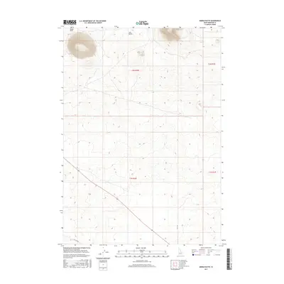
2017 Map of Middle Butte
USGS Topo · Published 2017About this map
Middle Butte dominates the northern horizon of this landscape, rising sharply from the surrounding Idaho high desert. This 2017 survey captures a largely undeveloped expanse of Bingham County, defined by the volcanic prominence of the butte and the nearby Twin Buttes. The land is meticulously gridded by the Public Land Survey System, showing the townships of t2n r32e, t2n r33e, t1n r32e, and t1n r33e. Transportation through this arid terrain is limited to a few arterial routes, including McTucker Rd and 1900 W Rd, which cut diagonally across the southern reaches of the quadrangle. The map is a study in topographic isolation, where the extreme elevation changes of the buttes contrast with the subtle, undulating floor of the Snake River Plain.
Find a feature on this map
8 named features on this map. Tap any name to fly to it.
Don’t see what you’re looking for? This feature index may not catch every label — zoom into the map to look around manually.
Map Details
Editions of this 2017 Middle Butte Map
This is the sole edition of this map. No revisions or reprints were ever made.
Other maps of this area

1955 · Idaho Falls
USGS Topo · 1:250,000

1958 · Idaho Falls
USGS Topo · 1:250,000

1973 · Olsen
USGS Topo · 1:24,000

1973 · Middle Butte
USGS Topo · 1:24,000

1973 · Taber
USGS Topo · 1:24,000

1973 · Atomic City
USGS Topo · 1:24,000

1973 · Lava Lake Reservoir
USGS Topo · 1:24,000

1973 · Circular Butte 3 SE
USGS Topo · 1:24,000

1973 · Little Butte SW
USGS Topo · 1:24,000

1973 · Little Butte
USGS Topo · 1:24,000