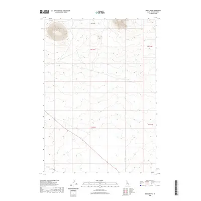
2020 Map of Middle Butte
USGS Topo · Published 2020About this map
Mid Butte dominates the northwestern corner of this high-desert landscape in Bingham County, rising as a prominent volcanic landmark above the Snake River Plain. This 2020 survey reveals the isolation of the Eastern Idaho landscape, characterized by vast expanses of sagebrush and lava fields interrupted only by the occasional peak like Twin Buttes. Human imprints are minimal and modern, centered primarily around access routes such as Mctucker Rd in the southwest and 1900 West Rd further east. These roads serve a sparse network of section lines, reflecting the organized township and range grid that divides this expansive territory. The geography here is defined by elevation rather than settlement, serving as a clear record of the volcanic topography that shapes this portion of the state.
Find a feature on this map
8 named features on this map. Tap any name to fly to it.
Don’t see what you’re looking for? This feature index may not catch every label — zoom into the map to look around manually.
Map Details
Editions of this 2020 Middle Butte Map
This is the sole edition of this map. No revisions or reprints were ever made.
Other maps of this area

1955 · Idaho Falls
USGS Topo · 1:250,000

1958 · Idaho Falls
USGS Topo · 1:250,000

1973 · Olsen
USGS Topo · 1:24,000

1973 · Middle Butte
USGS Topo · 1:24,000

1973 · Taber
USGS Topo · 1:24,000

1973 · Atomic City
USGS Topo · 1:24,000

1973 · Lava Lake Reservoir
USGS Topo · 1:24,000

1973 · Circular Butte 3 SE
USGS Topo · 1:24,000

1973 · Little Butte SW
USGS Topo · 1:24,000

1973 · Little Butte
USGS Topo · 1:24,000