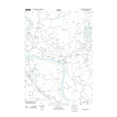
2012 Map of Middle Haddam
USGS Topo · Published 2012About this map
Connecticut River serves as the central artery for this region, winding past riverside landings and industrial sites such as Cobalt Landing and the Eureka Mill. The landscape is characterized by its numerous hills and water bodies, ranging from the high elevations of Chestnut Hill and Bald Hill Range to the significant recreational and geographic landmark of Pocotopaug Lake in the northeast. This area maintains a strong connection to its 18th and 19th-century foundations, evidenced by the density of legacy burial sites including the Portland Burying Ground and Swedish Cem.
Find a feature on this map
249 named features on this map. Tap any name to fly to it.
Don’t see what you’re looking for? This feature index may not catch every label — zoom into the map to look around manually.
Map Details
Editions of this 2012 Middle Haddam Map
This is the sole edition of this map. No revisions or reprints were ever made.
Other maps of this area

1892 · Gilead
USGS Topo · 1:62,500

1893 · Guilford
USGS Topo · 1:62,500

1893 · Middletown
USGS Topo · 1:62,500

1893 · Saybrook
USGS Topo · 1:62,500

1906 · Farmington
USGS Topo · 1:125,000

1928 · Cromwell
USGS Topo · 1:24,000

1928 · Glastonbury
USGS Topo · 1:24,000

1943 · Durham
USGS Topo · 1:25,000

1944 · Hartford South
USGS Topo · 1:31,680

1944 · Marlboro
USGS Topo · 1:31,680