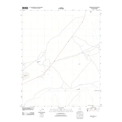
2011 Map of Middle Mesa
USGS Topo · Published 2011About this map
Greasewood Place serves as a notable landmark in this high-desert portion of Coconino County, situated near the western edge of Middle Mesa. The landscape is defined by its dramatic drainage systems and essential water sources, including Greasewood Lake and the eponymous Juanita Begay Spring. These features suggest a reliance on localized water points in an otherwise arid environment.
Find a feature on this map
9 named features on this map. Tap any name to fly to it.
Don’t see what you’re looking for? This feature index may not catch every label — zoom into the map to look around manually.
Map Details
Editions of this 2011 Middle Mesa Map
This is the sole edition of this map. No revisions or reprints were ever made.
Other maps of this area

1883 · Marsh Pass
USGS Topo · 1:250,000

1886 · Echo Cliffs
USGS Topo · 1:250,000

1891 · Echo Cliffs
USGS Topo · 1:250,000

1892 · Marsh Pass
USGS Topo · 1:250,000

1956 · Marble Canyon
USGS Topo · 1:250,000

1959 · Marble Canyon
USGS Topo · 1:250,000

1961 · Marble Canyon
USGS Topo · 1:250,000
1967 · Bat Canyon
USGS Topo · 1:24,000
1967 · Begashibito Canyon
USGS Topo · 1:24,000
1969 · Tuba City SE
USGS Topo · 1:24,000